Ordnance Survey has launched a new geospatial data tool designed to help developers, ecologists and public sector organisations meet Biodiversity Net Gain (BNG) requirements more efficiently, as the government ramps up housebuilding targets across England.

The organisation said its new OS Enhanced Land Cover (ELC) Beta dataset could help reduce the time needed for biodiversity assessments linked to planning applications, potentially supporting the government’s ambition to deliver 1.5 million homes during this Parliament.
Under Defra’s BNG legislation, developers must demonstrate at least a 10 percent biodiversity improvement as part of planning applications. This includes assessing existing habitats, submitting biodiversity gain plans, delivering gains either on or off site, and maintaining habitats for 30 years. The rules are also set to expand later this year, with Defra confirming that BNG requirements will become mandatory for Nationally Significant Infrastructure Projects from November.
OS said the ELC dataset brings together multiple geospatial and habitat sources into a single platform, including data from the OS National Geographic Database, aerial imagery, terrain mapping, Natural England’s Living England dataset, the Rural Payments Agency’s Crop Map of England and the UKHab habitat classification framework.
The company said this could help provide faster provisional habitat assessments both during desktop analysis and in-field ecological surveys.
Dr Jack Parkin, product manager for the built and natural environment at Ordnance Survey, said the combination of government housing targets and biodiversity legislation was creating significant demand pressures for ecological expertise.
“The Government’s home-building target, combined with Defra’s BNG legislation, has made a market condition where ecologists are in high demand,” he said.
“One of the benefits of OS Enhanced Land Cover is to boost the productivity of those ecologists and to make their time count. We aggregate multiple geospatial datasets together to provide a provisional assessment of habitats on the ground which saves ecologists time both in desktop analysis and pre-screening in the field.”
Parkin added that the approach could “shave days, or even weeks, from development times”.
The dataset is already being used in industry pilots. Utility provider Wessex Water has used the data to analyse biodiversity across hundreds of sites simultaneously as part of its long-term BNG planning, according to OS.
Geospatial startup Linckia, part of the Geovation Accelerator programme, has also integrated the OS ELC dataset into its Habitat Fabric platform on ESRI technology.
If you liked this content…
 Data in 2026: From Accumulation to Accountability
 Women in Digital: Debbie Wilson
 Future-proofing Geospatial Intelligence: How Ordnance Survey is Embedding AI Responsibly
 How can government ensure public trust in data?
 Blueprint for Modern Digital Government: Breaking down barriers in public service delivery
Luke Chittock, co-founder of Linckia, said the approach had reduced processing costs significantly.
“We really like OS Enhanced Land Cover, which we integrate into Linckia’s BNG solution on the ESRI platform,” he said. “It gives us a scalable, authoritative, and auditable approach that we can trust, delivering better outcomes for our customers.”
Chittock said the company had seen “a 40 percent reduction in data processing costs from earlier approaches”, rising to 90 percent compared with processing imagery separately.
Beyond housing development, OS said the dataset could also support wider public sector environmental planning initiatives, including flood risk management, green corridors and rewilding projects.
OS National Geographic Database
The announcement comes alongside a broader expansion of the OS National Geographic Database (OS NGD), which the organisation described as the “most detailed and data-rich digital map in history”.
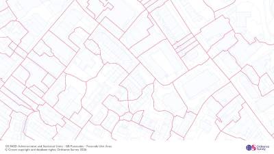
The latest update to the national geospatial platform includes full Great Britain coverage of bus and cycle lanes, enhanced postcode and retail datasets, and improved infrastructure data aimed at supporting emergency services and local authorities.
OS said the NGD now contains 16 data collections and 70 major data enhancements, helping public sector organisations use location data to support areas including transport management, healthcare planning, environmental initiatives and climate resilience.
Tina Kennedy, chief customer officer at Ordnance Survey, said location data was increasingly becoming critical national infrastructure for both public and private sector decision-making.
“OS has since evolved into a data powerhouse which supports many different sectors with critical and actionable insights – from insurance and property to local authorities under pressure to meet biodiversity net gain targets,” she said.
The expanded datasets have been released through the Public Sector Geospatial Agreement, the government framework that provides geospatial data access to around 6,000 public sector organisations across Great Britain.